“A goldmine of information and for a traveller, irresistible temptation.”- Michael Palin
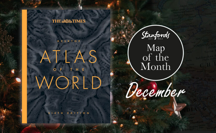
Everyone needs a good world atlas and this one is perfect for everyday use at home or work. This is the fully updated sixth edition published earlier this year.
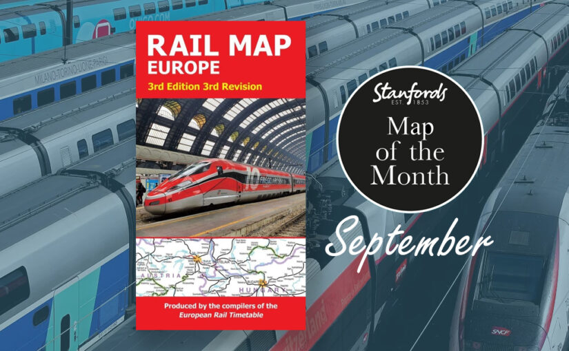
Our Map of the Month is the European Rail Map. The definitive rail map for today’s independent traveller, this map is a regular feature on our bestsellers list. This is the third revision of the 3rd edition map which includes the latest high-speed routes and updates.
From the same people who print the European Rail Timetable, this map seeks to show all passenger rail routes in Europe (other than those of the suburban networks of major cities).
Here are five maps that have caught our attention recently at Stanfords:
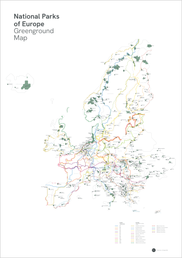
National Parks of Europe Greenground Map
£24.99
NEW
From the graphic designer and map maker that brought you our Map of the Month back in May; The London Greenground Map, Helen Ilus has just launched this new minimalist map that aims to connect Europe’s National Parks with official long-distance walking and cycling routes. With 400+ National Parks, 12 official E-paths and 17 EuroVelo routes, the map is a useful tool for planning nature adventures across Europe either on foot or on bike. The visually stylised map makes the connections between National Parks easy to see and helps with the planning as well as being an inspiring wall map between the adventures.
Urban Good launches London Flipped, the first ever full-size upside down map of London. This innovative map offers a unique perspective on the capital, challenging conventional viewpoints and inviting Londoners and visitors alike to explore the city in a whole new way.
A Fresh Take on London
London Flipped rotates the traditional map of London by 180°, placing south at the top and north at the bottom. This playful yet thought-provoking reorientation is designed to disrupt conventional navigation and encourage users to reimagine their spatial relationships with the city.
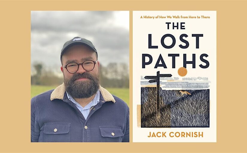
In my recently published book, The Lost Paths, I explore the paths which reach into – and connect – communities across England and Wales. A network of paths which reveal how our ancestors have interacted with and shaped their surroundings over millennia. On the paths I discovered hundreds of stories – tales of love, commerce, death, graft and communication.
There are over 140,000 miles of recorded public rights of way in England and Wales, which started to be proactively and legally recorded from the early 1950s onwards. But tens of thousands more are missing from the maps, lying unclaimed and unprotected. So, as well as a celebration of an ancient network, I hope The Lost Paths will serve as a call to arms to reclaim and save our old paths – to preserve our history on foot. Below are some of my top tips for finding lost paths along with some of the paths that captivated me when writing The Lost Paths.
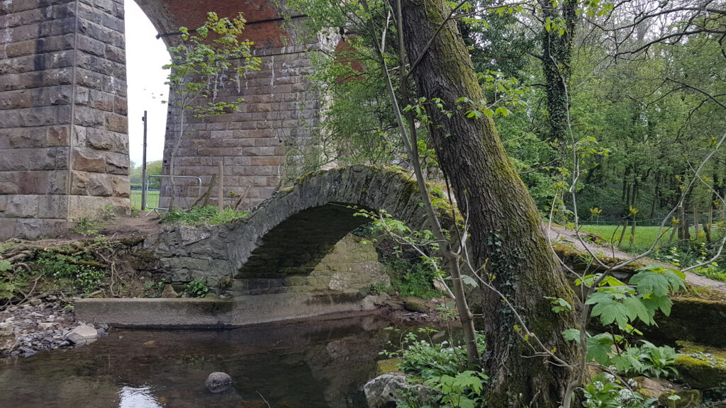
Look out for old stiles, bridges and fords – Often paths leave an impression, they are physical objects in the landscape. They are perhaps at their most tangible when they cross boundaries, natural and manmade. In The Lost Paths, I write about a lost path I walked in Lancashire, well used but not recorded as a public right of way. A wide track, with grass banks which merge into the surrounding hedges, with trees standing alongside as sentinels which mark the gentle drifts and curves of the lane. At its southern end, the path crosses a river – a quietly enchanting, almost hidden spot. In the riverbed can be seen the cobbles of an old ford and above the water, a beautiful, hunched packhorse bridge. These are tell-tale signs that the public have been coming this way for hundreds of years. Just some of the physical clues, alongside objects like old worn stiles buried in a hedge, that you may be looking at a lost public path.
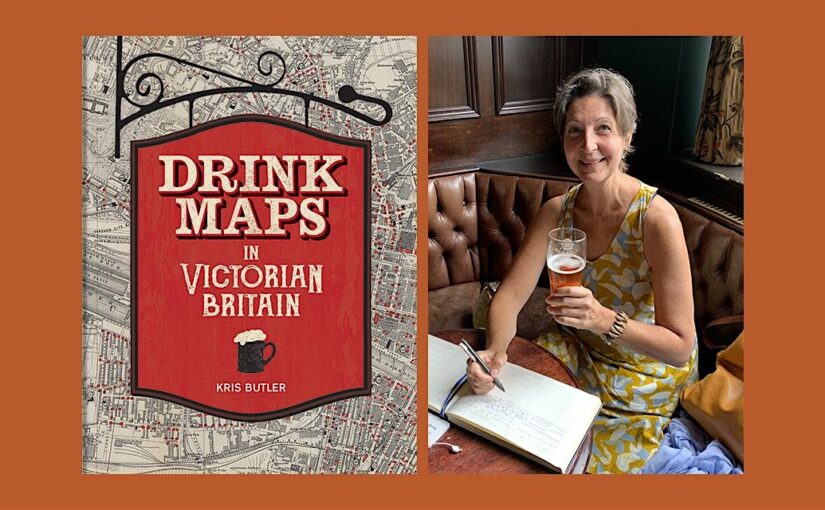
“This is the story of drink maps, and it’s probably not what you think”
Last week we were joined by Kris Butler for a fascinating exploration of the history of alcohol in Victorian Britain via the ‘drink maps’ that were produced by the temperance movement to promote sobriety.
It’s not about pub crawls or plotted ale trails. Instead, these are maps with an agenda that was adamantly hostile to drinking alcohol, made by an organized faction known as the Temperance Movement. The logic at the time of the maps’ creation went as follows: if people are shown how many places there are to buy alcohol, they will be so appalled that they will join the effort to end drinking. In hindsight this logic is obviously flawed.’
Drink Maps in Victorian Britain explores how drink maps of cities were published to fight increasingly rampant alcohol consumption, from Liverpool,Manchester and Sheffield to Oxford, London, and Norwich.
Drink maps were created by anti-drinking groups to deter drinking, not encourage it. But you might not guess that when you first look at them, given that they exaggeratedly and colourfully show where to find a drink. What this 1877 map, called One Half-Mile Square in the Heart of London, lacks in colour it made up for in size. The original was a whopping 8 foot by 8 foot, floor-to-ceiling backdrop to a traveling temperance lecture given by Dr Thomas Nichols. This image is of the pocket version; the larger one is not known to have survived.
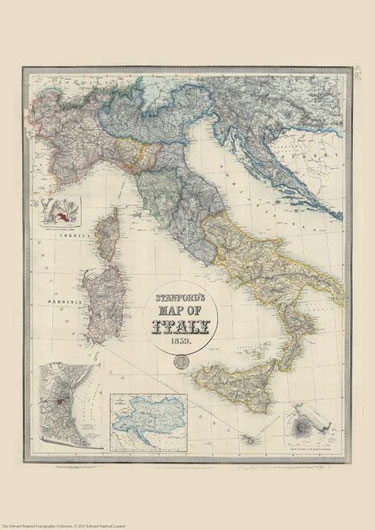
We are celebrating this map’s 165th birthday. It was originally published on 2nd May 1859 by Edward Stanford.
The map catches the country in an interesting stage of its history, just before the unification, and still shows the individual states: the Kingdom of Piedmont – Sardinia, the Grand Duchy of Tuscany, the Kingdom of the Two Sicilies, the Papal States, etc, all in different colours. Hachures are used to show the spine of the Apennines and other mountainous regions.
Interesting insets show enlargements of the environs of Venice, Genoa and Naples with Vesuvius, and another panel presents the whole of the Austro-Hungarian Empire which then still included Lombardy and north-eastern Italy.
This reproduction is Print on Demand so is available in other sizes.