This site requires cookies for account access and purchasing. By using this site you give implied consent. For more information please review our use of cookies in our Cookie Policy and then Accept and Close this bar.



Stanford's New Library Chart of the World (1920) - Original Size Wall Map, Paper - Print on Demand
£59.99
ISBN
9786000531669
Publisher:
Edward Stanford Cartographic Collection
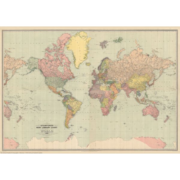
Print on Demand map from the Edward Stanford Cartographic Collection archive.
The Stanford’s New Library Chart of the World is from a fascinating series of reproductions from our Edward Stanford Cartographic Collection archive.
This map was published by Stanfords in January 1920 and says ‘drawn to an equatorial scale of 350 nautical miles to 1 inch.
Displays submarine telegraph cables.
Published just after World War I the boundaries are as per the Treaty of Versailles. The British Empire, at its height, is shown in dark pink.
This is a very interesting map for anyone with an interest in history as it shows the world as it was in the 1920s from a British cartographer’s viewpoint.
This is the full size original version on paper. Dimensions: 190.2 x 132.1cm (hor x ver).
| Author | E.Stanford PAPER |
|---|---|
| Format | Sheet map, rolled |
| ISBN | 9786000531669 |
| Publisher | Edward Stanford Cartographic Collection |
| Size Unfolded | 190.2 x 132.1cm |
Write Your Own Review
There are no answered questions for this product yet.