This site requires cookies for account access and purchasing. By using this site you give implied consent. For more information please review our use of cookies in our Cookie Policy and then Accept and Close this bar.

Alps Map inspired by Tolkien A2 Size Joshua Tabti Art
£40.00
ISBN
9786000662134
Delivery
1 available / in stock online
1 available / in stock online
Click & Collect
1 in stock at London Store
1 in stock at London Store
Publisher:
Joshua Tabti Art
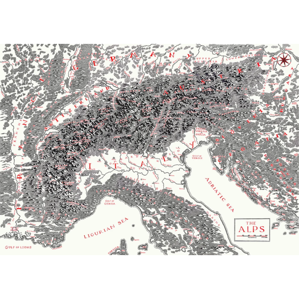
Map of The Alps featuring the tallest and most prominent mountain peaks spanning France, Switzerland, Germany, Italy, Austria, Slovenia & Croatia, inspired by Tolkien's fold-out maps of Middle Earth featured in the books The Lord of the Rings and The Hobbit.
A2 Fine art print on heavyweight 200gsm paper. Frame not included.
This map was originally hand illustrated using traditional dip pen and ink and annotated with calligraphy, following meticulous research into land cover, terrain and landmarks to create a geographically and culturally accurate survey.
A2 Fine art print on heavyweight 200gsm paper. Frame not included.
This map was originally hand illustrated using traditional dip pen and ink and annotated with calligraphy, following meticulous research into land cover, terrain and landmarks to create a geographically and culturally accurate survey.
| Format | Sheet map, rolled |
|---|---|
| ISBN | 9786000662134 |
| Publisher | Joshua Tabti Art |
Write Your Own Review
There are no answered questions for this product yet.