This site requires cookies for account access and purchasing. By using this site you give implied consent. For more information please review our use of cookies in our Cookie Policy and then Accept and Close this bar.



Cinque Terre [2450] 1:35,000 Waterproof Hiking Map
£11.99
ISBN
9783991217459
Publisher:
KOMPASS-Verlag
Contoured hiking map with local footpaths
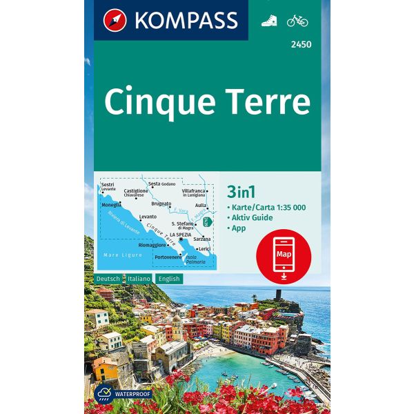
Cinque Terre area of the Ligurian Coast on a double-sided, contoured and GPS compatible recreational map at 1:50,000 from Kompass, printed on durable, waterproof and tear-resistant synthetic paper. Coverage includes La Spezia and the Montemarcello Magra Regional Park. In addition to numerous local hiking trails and long-distance routes such as the Alta Via dei Monti Liguri or Alta via del Golfo, the map also shows cycling routes and a selection of mountain bike routes.
KOMPASS HIKING MAPS OF ITALY – TO SEE THE OTHER TITLES IN THIS SERIES PLEASE CLICK ON THE SERIES LINK. The series covers the northern part of the Italian Alps, the lake region of Lombardy, the Dolomites, selected parts of Tuscany and Umbria, the Sorrento Peninsula, central Sardinia and the islands of the Tyrrhenian Sea. Coverage of the Dolomites by Kompass at more detailed scales (mainly 1:25,000) is listed on our website in a separate series (please search for SI00000405). Kompass are Europe’s largest publishers of walking maps, with extensive coverage of hiking areas in other countries, all listed on our website.
CARTOGRAPHY: Contour interval varies according to the terrain, 40m in most titles. Colouring and/or graphics show different types of the terrain, including woodlands, vineyards, heath, exposed rock, etc. All the maps highlight local hiking paths indicating, where appropriate, long-distance routes or via ferrata trails. Symbols show various types of accommodation such as selected inns and hotels, campsites, mountain huts and refuges, etc. Most titles also include cycle or mountain bike trails and/or ski routes.
GPS COMPATIBILITY & MAP LEGEND: All the titles are GPS compatible with a UTM grid, unless indicated to the contrary in the individual description. Map legend includes English.
DURABILITY: Many new editions are now published on sturdy, waterproof and tear-resistant synthetic paper, as indicated in the individual description.
BOOKLETS: PLEASE NOTE BEFORE ORDERING! - Many titles come with a booklet describing the area and/or various hiking routes. Unless indicated in the individual description that the booklet includes English, these booklets are in Italian and German only. The booklets are not necessary to use the maps since, as stated above, full English language map legend is provided.
| Author | UNKNOWN |
|---|---|
| Format | Sheet map, folded |
| ISBN | 9783991217459 |
| Publisher | KOMPASS-Verlag |
| Reference | 2450 |
| Scale | 1:35,000 |
| Size Folded | 11x18cm |
Write Your Own Review
There are no answered questions for this product yet.