This site requires cookies for account access and purchasing. By using this site you give implied consent. For more information please review our use of cookies in our Cookie Policy and then Accept and Close this bar.



Lake Garda and its Surroundings [697] 1:35,000 Hiking 3 Map Set
£16.99
ISBN
9783991218593
Publisher:
KOMPASS-Verlag
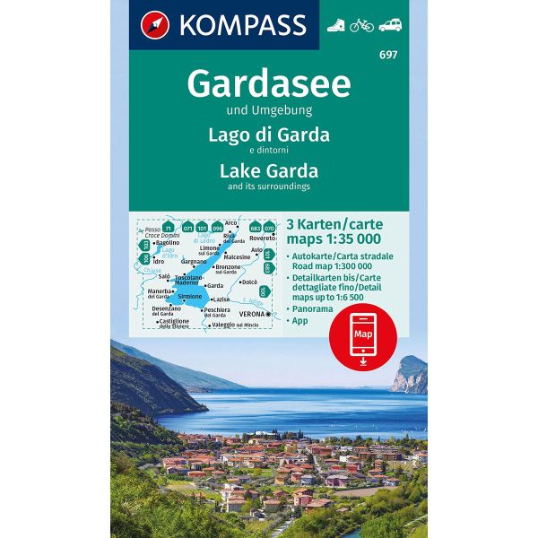
Lake Garda and its Environs in a set of three maps from Kompass combining topographic coverage at 1:35,000 for recreational pursuits, a beautifully drawn panorama map, plus a road map and street plans of central Verona, Riva del Garda and Peschiera. The set consist of:
RECREATIONAL MAPS: two double-sided maps providing topographic coverage of the area at 1:35,000 as part of the publishers’ extensive series of detailed mapping of the Dolomites and the surrounding region. Contours are at 40m intervals, enhanced by relief shading and with plenty of names of various geographical features: mountain ranges, peaks, valleys, etc. An overprint, graded according to the degree of difficulty, highlights hiking trails, indicating their regional numbers and where appropriate long-distance routes. Via ferrata section are marked. Also highlighted are cycling routes, plus a selection of mountain bike trails and cross-country ski tracks. A very wide range of symbols indicate various services and places of interest: different types of accommodation including campsites, youth hostels, Friends of Nature houses, mountain huts, etc; viewpoints, remarkable trees, etc. Gondola, chair lifts and other mountain transport is shown and on the local roads bus stops are marked and scenic routes are highlighted. The maps have a UTM grid for GPS. Map legend includes English.
PANORAMA MAP: in the publishers’ long-standing tradition, a beautifully drawn panorama map of the area with the peaks of the Tyrolean Alps in the distance. The map shows the road network and names not only towns and villages but also numerous peaks and mountain ranges.
ROAD MAP AND THE STREET PLANS: on the reverse of the panorama map is a road map at 1:430,000 showing access from Germany and Austria to Lake Garda and the A4/E70 motorway corridor (Milan – Verona – Venice). Coverage extends north-west to Stuttgart and east to Salzburg and Udine. Also provided here are street plans of central Verona, Riva del Garda and Peschiera.
OTHER KOMPASS MAPS OF THE LAKE GARDA AREA: to see the list of Kompass maps is this series please click on the series link.
RECREATIONAL MAPS: two double-sided maps providing topographic coverage of the area at 1:35,000 as part of the publishers’ extensive series of detailed mapping of the Dolomites and the surrounding region. Contours are at 40m intervals, enhanced by relief shading and with plenty of names of various geographical features: mountain ranges, peaks, valleys, etc. An overprint, graded according to the degree of difficulty, highlights hiking trails, indicating their regional numbers and where appropriate long-distance routes. Via ferrata section are marked. Also highlighted are cycling routes, plus a selection of mountain bike trails and cross-country ski tracks. A very wide range of symbols indicate various services and places of interest: different types of accommodation including campsites, youth hostels, Friends of Nature houses, mountain huts, etc; viewpoints, remarkable trees, etc. Gondola, chair lifts and other mountain transport is shown and on the local roads bus stops are marked and scenic routes are highlighted. The maps have a UTM grid for GPS. Map legend includes English.
PANORAMA MAP: in the publishers’ long-standing tradition, a beautifully drawn panorama map of the area with the peaks of the Tyrolean Alps in the distance. The map shows the road network and names not only towns and villages but also numerous peaks and mountain ranges.
ROAD MAP AND THE STREET PLANS: on the reverse of the panorama map is a road map at 1:430,000 showing access from Germany and Austria to Lake Garda and the A4/E70 motorway corridor (Milan – Verona – Venice). Coverage extends north-west to Stuttgart and east to Salzburg and Udine. Also provided here are street plans of central Verona, Riva del Garda and Peschiera.
OTHER KOMPASS MAPS OF THE LAKE GARDA AREA: to see the list of Kompass maps is this series please click on the series link.
| Format | Sheet map, folded |
|---|---|
| ISBN | 9783991218593 |
| Publisher | KOMPASS-Verlag |
| Reference | 697 |
| Scale | 1:35,000/300,000 |
| Size Folded | 11x18.5cm |
| Size Unfolded | 74x110cm |
Write Your Own Review
There are no answered questions for this product yet.